
Away message
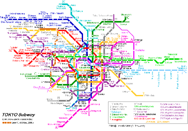
Maps of public transportation are my favorite visual shorthand for any major city, not only because I have to rely on mass transit where ever I go, but also because these highly stylized versions of cities contain much more than the bare minimum amount of information to get from one point to the next. I will be in Tokyo checking out the public transit system and attending the 4S conference through the end of the month.
See you back here in September.
")

![New York City - Upper East Side [from envisioning development]](https://thesocietypages.org/graphicsociology/files/2009/12/upper_east_side_sm.png "New York City - Upper East Side {from the Center for Urban Pedagogy, envisioning development project}")
![New York City - East Harlem [from envisioning development]](https://thesocietypages.org/graphicsociology/files/2009/12/east_harlem_sm.png "New York City - East Harlem {from the Center for Urban Pedagogy, envisioning development project}")

")


