
Just thought this was cool
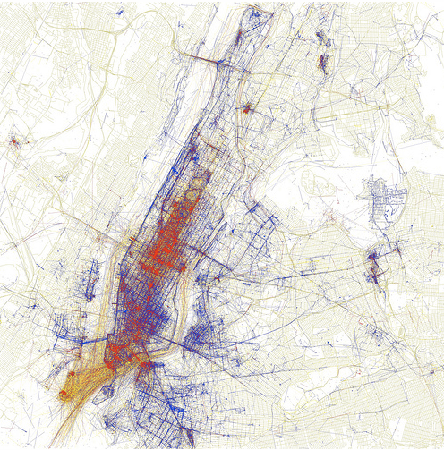
This map of New York was created by Eric Fisher. He gathered the geotags of the photos uploaded to flickr. The colors work like this: blue photos were taken by locals (deemed to be local because they had taken pictures in the same location over an extended period of time), red indicates photos taken by tourists (people taking photos outside of their frequent-photo-taking-zone), and the yellow ones were indeterminate (taken by people who hadn’t uploaded any photos in the previous 30 days though we guess they might be tourists because they may be the kind of people who only take photos while on vacation).
I like the aesthetic and the method so that’s why I decided to share.
Comments 1
Dale — August 16, 2010
It would be cooler without the map underlay.