
Geographer Derek Watkins put together an interesting visualization of the expansion of the U.S. by showing the distribution of post offices between 1700 and 1900. The distribution of post offices reflects a number of important social and political events — the sudden emergence of post offices on the West Coast in the late 1840s, around the time of the gold rush and California becoming a state, patterns in Kansas and Nebraska in the 1870s clearly showing how population growth followed railroad lines, and so on:
Posted: Visualizing US expansion through post offices. from Derek Watkins on Vimeo.
You can read Watkins’s caveats about the data (it doesn’t include closures of some post offices during that time, and he was unable to determine the location of about 10% of post office branches) here. Thanks to Jeremy Freese, at Scatterplot, for posting it!
Dmitrity T.M. and Larry Harnisch (of The Daily Mirror) let us know that Stanford University’s Rural West Initiative put together a map showing the spread of newspapers across the U.S. between 1690 and 2011, based on Library of Congress listings. The results illustrate many of the same major social and political changes and trends as the post office map:
The Growth of US Newspapers, 1690-2011 from Geoff McGhee on Vimeo.
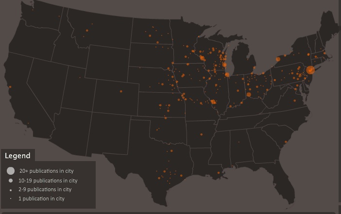
The website allows you to see the map for any individual year, and awesomely, you can filter by language, illustrating a number of periods of high immigration and common destination locations. Here’s the map of German-language newspapers in 1900:
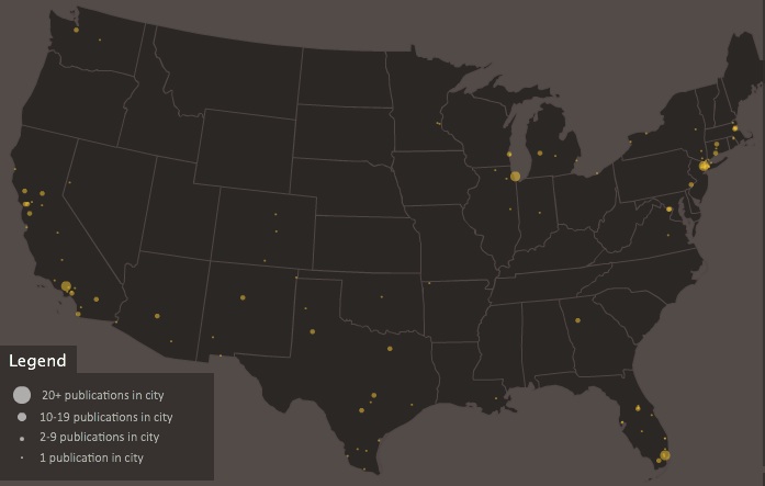
And Spanish today:
Comments 2
[links] Link salad heads to Kumoricon | jlake.com — September 3, 2011
[...] Visualizing U.S. Westward Expansion: Papers and Post Offices [...]
Yrro Simyarin — September 4, 2011
Very, very cool. I love how you can see the railroad lines.