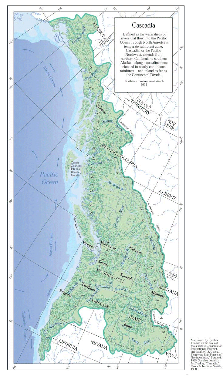
 The Sightline Institute has reports and maps on sustainable regional development. They have a Cascadia Scorecard that tracks cities along seven key dimensions:: health, economy, population, energy, sprawl, wildlife, and pollution.
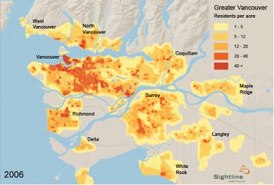
“The Scorecard’s target measurement for sprawl is 64 percent of a metropolitan area’s urban and suburban residents living in transit-friendly, walkable neighborhoods. That was the average for Vancouver, BC, Canada as of 2001 — the most recent data that was available when the Cascadia Scorecard was launched in 2004. Vancouver has the best smart-growth record among Cascadian cities. In fact, it has the most compact urban structure of any of the 19 cities Sightline has analyzed to date.”

Here is a summary of research on British Columbia. I was in Vancouver, BC this past May and I can attest to the fact that it is a very walkable city. One of the things I look at in cities is how geography shapes growth, such as mountains and bodies of water. Steep mountains, Burrard Inlet, and the Fraser River have all played a role in resisting the pressure for widespread sprawl. In the lower mainland area of British Columbia, where Vancouver is, policies are in place to protect farmland and to channel development.
Twitterversion:: @Sightline Institute has great resources for understanding sustainable develment w/studies of #Cascadia. http://url.ie/2jde #ThickCulture @Prof_K
Song:: Atmosphere – Pink Mountaintops {Vancouver, BC, CA}

Comments 5
Patrick Hollingworth — July 13, 2013
Thanks so much for providing individuals with a very special chance to read critical reviews from this web site. It is usually very beneficial plus packed with a lot of fun for me personally and my office mates to visit your web site at the least thrice weekly to find out the latest stuff you have got. Of course, I'm also certainly satisfied considering the powerful tricks you serve. Certain 1 points in this posting are undeniably the most beneficial I've had.
podos — September 4, 2025
Really interesting read on Cascadia and how geography plus smart-growth policies shape sustainable cities like Vancouver. The way natural barriers such as mountains and rivers help limit urban sprawl is a good reminder of how much location matters in development planning.
On a completely different note about how regions evolve with their unique strengths — cricket is doing something similar in the UAE right now. The country has become a growing hub for international cricket, and at the moment the T20I Tri Series 2025 is taking place with Pakistan, Afghanistan, and UAE competing. Fans are keeping a close eye on the tri series points table 2025 since every match is shifting the standings and deciding who will reach the final. It’s fascinating to see how the UAE, much like Vancouver with sustainability, is carving out its own place in world cricket.
jhonwood — October 4, 2025
That’s a fascinating insight! Vancouver’s approach to urban planning and smart growth reminds me of how important structured systems like Nadakacheri are for managing regional development effectively. Just like Vancouver promotes walkable, sustainable communities, Nadakacheri plays a key role in organizing and delivering citizen services efficiently. It’s great to see how both planning and administration can shape a better future for everyone.
Rodriguz — November 3, 2025
En países como México, Guatemala, Perú o Colombia, la Semana Santa 2026 será una semana de fervor y esperanza. Alfombras coloridas, procesiones y actos litúrgicos llenarán las ciudades, mezclando la espiritualidad católica con costumbres locales únicas.
Aiden — November 19, 2025
This is a genuinely interesting look at how geography and smart policy shape livability. Cascadia — especially Vancouver — often sets the benchmark for walkable, sustainable urban planning, and it’s impressive how natural barriers like mountains and waterways actually help guide smarter development instead of uncontrolled sprawl. Sightline’s work shows how thoughtful regional planning can create healthier, more connected communities.
And just like cities evolve with strategy and vision, global cricket is evolving too — with events like the ICC T20 World Cup 2026 bringing even more international attention to how different nations grow, adapt, and perform on the world stage.