I am teaching Elijah Anderson’s Code of the Street in my Introduction to Sociology class, and I have found that an excellent supplement to the text is the “Street view” of Google Maps. With a simple internet connection, you can type in addresses into maps.google.com and show students the places Anderson describes in the book.
Anderson begins the book with a descriptive tour of Germantown Avenue, starting in the wealthier and middle class neighborhoods and continuing through the ghettos described throughout the book. As you read the introduction, you can follow his description of the street with Google maps. The “Street view” allows you to “drive” up and down the street, look all around, and actually see how the ghettos are different from the middle-class neighborhoods that are his comparative foil.
The entire street is not photographed in this way, but much of it is. You can detour off Germantown Avenue as well, following other major arteries and smaller streets through the city.
Here are the instructions and some screenshots. I don’t know much about Philadelphia; this is only based on Anderson’s descriptions. Perhaps those more knowledgeable than I can fill in some details?
Go maps.google.com and type in the following addresses. Then click on “Street view” and navigate up and down the street as you desire.
“8500 Germantown Ave., Philadelphia, PA” takes you to a little shopping district in Chestnut Hill, the upper-middle class nighborhood that Anderson starts out with. You can go all the way up to about 9500 or so.
“7600 Germantown Ave., Philadelphia, PA” transitions into the Mt. Airy neighborhood, a more racially mixed middle class neighborhood. The street view ends at 7200.
“4600 Germantown Ave., Philadelphia, PA,” Here the Street View starts up again and goes for a few blocks before turning off on Windrim Ave.
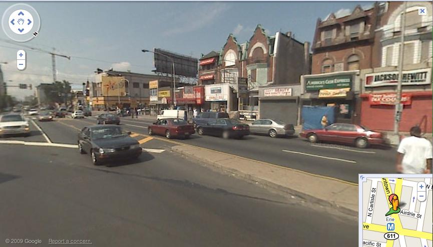
“3700 Germantown Ave., Philadelphia, PA”–Corner of Broad St, “one of the centers of the North Philadelphia ghetto”

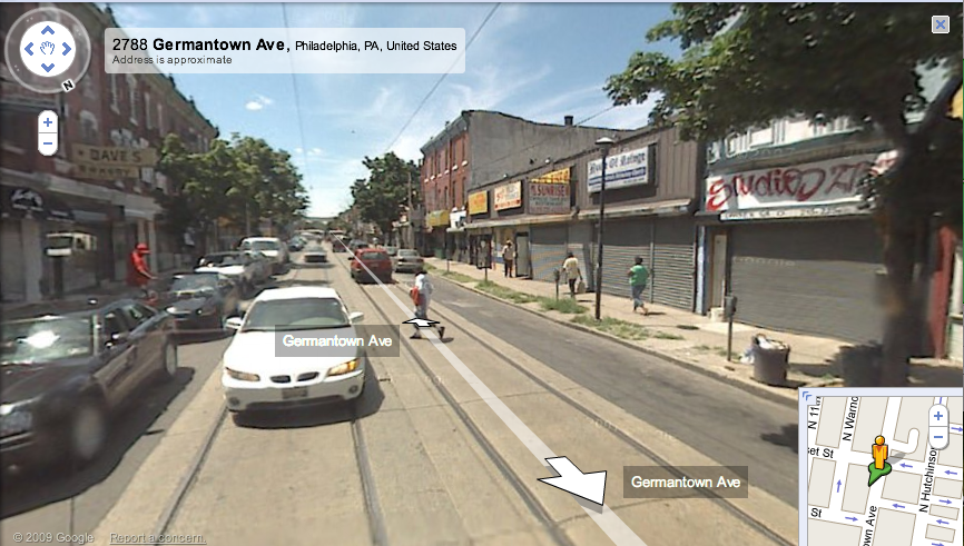
“2900 Germantown Ave., Philadelphia, PA.” Here, you start to see the empty lots, barred windows, and shuttered buildings.

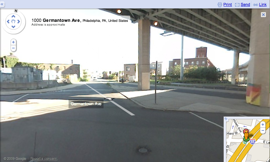
“1000 Germantown Ave., Philadelphia, PA.” Where the street ends under the interstate:

———————
Peter Hart-Brinson is a Ph.D. candidate at the University of Wisconsin-Madison. He is a cultural sociologist and is working on a dissertation about gay marriage. His post is inspired by Elijah Anderson’s Code of the Street… so it’s for serious sociological nerds.
If you would like to write a post for Sociological Images, please see our Guidelines for Guest Bloggers.

Comments 4
Robin — February 22, 2009
As a Philadelphia native, one interesting thing to note (and it's a shame you can't see it on google street view), is that there has been an active effort by community members in the last few years to change the face of Germantown Avenue in Mount Airy (the area north of the park and the library) and make it into a place that the middle class folks (who Anderson suggest would rather do their shopping elsewhere) feel more comfortable frequenting, both for shopping and socializing. Indeed, recent night out there showed street traffic much more representative of the racial mix of Mount Airy at large than what Anderson would have seen when he was researching this book.
Danielle — March 5, 2009
I have taken the 23 Septa bus along Germantown Avenue many times, although since I am from the ghetto side of town I have always started in the "ratty" parts and ended up in Chestnut Hill, never the other way round. It has fascinated me since I was a little girl. It's the same cobblestone streets, the same old Philadelphia buildings with similar facades, but the street just gradually changes. Buildings and homes that seem right on top of each other start to seem "cozy" and "comfortable".
The cobblestones go from being uneven to perfectly placed, the buildings from somewhat ratty to impeccable, the facades from "old and rundown" to "deliciously quaint". From black to white, with Mt. Airy as the in-between.
ronilo acabo — February 20, 2010
Philadelphia and resident should see to it that William Penn's intention when he laid the foundation of the city be consistently maintained. After all, the beauty and tidiness of this city reflect the the characters of the founders of settlements in the new world.
tinktank » Gomorrah Street View — August 30, 2011
[...] [2] Sociological Images: « Using Google Maps to Teach Urban Ethnography» – http://thesocietypages.org/socimages/2009/02/18/guest-post-using-google-maps-to-teach-urban-ethnogra... [...]